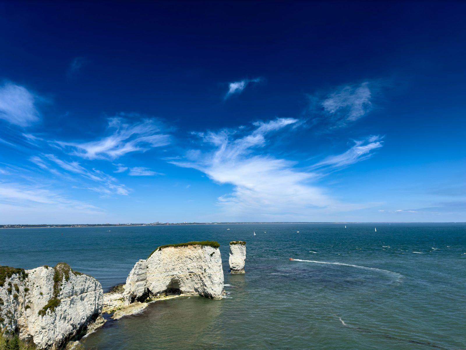
Dorset
Poole Harbour and Sandbanks coastal map wallpaper
One of the world’s largest natural harbours.
Poole Harbour and Sandbanks is available as a made-to-measure nautical chart wall mural from Coastal Chart Wallpaper. Enter your wall size for an instant price from £48 per square metre (minimum £195); a 3 × 2.4 m wall is about £346. You approve a proof of your exact stretch of coast before anything is printed, it is made in the UK, and UK delivery is free. The area includes Poole Harbour, Brownsea Island, Sandbanks, Studland Bay, Poole Quay, Arne and Old Harry Rocks. It makes a lovely Dorset gift for anyone who loves this stretch of coast, and gift vouchers are available.
The coast
About Poole Harbour and Sandbanks.
Poole Harbour is one of the largest natural harbours in the world, with Brownsea Island in the middle and Sandbanks guarding the narrow entrance opposite the chain ferry to Studland. Shallow channels wind between the islands and saltmarsh, and Old Harry Rocks stand at the end of Studland Bay.
Perfect for: Homes in Sandbanks, Canford Cliffs and around the harbour, boat owners at Poole Quay, and families who know Studland beach.
On the chart
- Poole Harbour
- Brownsea Island
- Sandbanks
- Studland Bay
- Poole Quay
- Arne
- Old Harry Rocks
Your proof shows exactly which part of the chart fits your wall, so you can ask us to centre it on the place that matters to you.
Made to measure
Price your Poole Harbour and Sandbanks wall.
Enter your wall. See the price. Approve your proof before we print.
Measure the bare wall. We add the trimming allowance. How to measure
Your wall to scale, beside a 1.8 m figure
- Your wall
- We print
- Proof before we print
- Reprint or refund if it’s not as approved
- Free UK delivery
On the wall
How a chart wall looks.
These rooms show charts we already hold. Your Poole Harbour and Sandbanks mural is printed from a nautical chart of this coast, and you see a proof first.
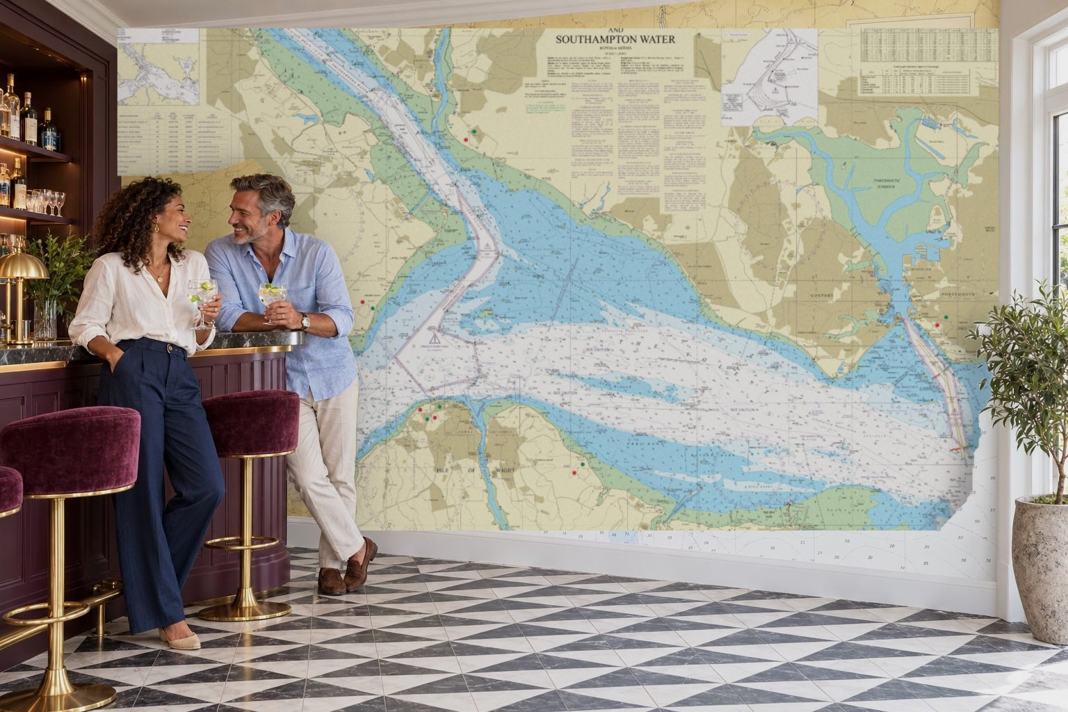 Shown: The Solent + Southampton Water
 Shown: Outer Approaches to the Solent
How it works
Four simple steps.
Pick your chart
Choose the stretch of coast you love and the part of the chart you want.
See it on your wall
Say how big your wall is and see it with an instant price. Add a photo of your own wall if you like.
Approve your proof
We send a proof of your exact wall. Nothing is printed until you say yes.
We print and deliver
Printed in the UK and delivered free, in numbered drops. We suggest a professional paperhanger or decorator to hang it.
Questions
Poole Harbour and Sandbanks: what to know.
Which places are on the Poole Harbour and Sandbanks chart?
The area includes Poole Harbour, Brownsea Island, Sandbanks, Studland Bay, Poole Quay, Arne and Old Harry Rocks. Your proof shows exactly which part fits your wall, and we can centre it on the place that matters most to you.
Is the Poole Harbour and Sandbanks wallpaper a real nautical chart?
Yes. Every mural is printed from a nautical chart of the area. The pictures on this page are ideas to inspire you; your proof shows the real chart before anything is printed.
How much does a Poole Harbour and Sandbanks chart mural cost?
Our paste-the-wall paper is £48 per square metre, with a minimum order of £195. A 3 × 2.4 m wall is about £346 in Standard. UK delivery is free.
What size can you print?
Any wall up to 6 metres wide and 4 metres high, printed to your exact measurements with a trimming allowance on every edge. Bigger walls are possible as a bespoke order.
Do I see it before it is printed?
Yes. After you order we send a proof showing exactly which part of Poole Harbour and Sandbanks fits your wall. Nothing is printed until you approve it. If your wall arrives damaged, faulty or different from the proof you approved, we’ll reprint it or refund you in full.
How is it hung?
We suggest a professional paperhanger or decorator. The mural arrives as paste-the-wall paper in numbered drops 62 cm wide. If you are confident and have a helper, you can hang it yourself: paste the wall, then hang each drop in order.
Can I use it to navigate?
No. It is decorative wallpaper, not a navigational chart.